The meta-modeling approach provided an environment to loosely or tightly couple other models such as operations models, fish habitat models, and water quality models.
The benefits realized to date include an improved focus on science and use of the best available information for planning; water supply planning that is more dynamic and supports the water withdrawal permitting process; and the permitting of projects that provide greater resource optimization.
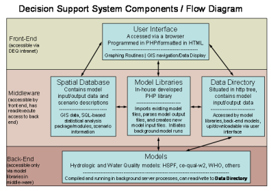
Decision Support System Components/Flow Diagram
The Decision Support System Components/Flow Diagram displays the connections between models. The User Interface is the front end, which is connected to the Spatial Database, Model Libraries and Data Directory in the middleware. The models themselves are on the back end of the system. They provide data to the Model Libraries and Data Directory.
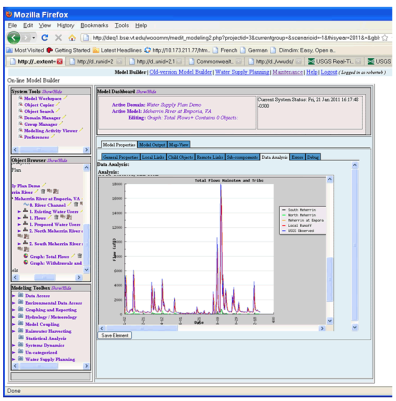
Online Model Builder Graphic
The screenshot of the online model builder displays a graph of a river flow and windows of the various tools that can be included in the coupled model.

