The WSU Campus Reality Capture and Digital Twin Initiative brings together faculty, graduate students, and industry collaborators to develop a repeatable workflow for capturing campus facilities as digital datasets. By integrating surveying, LiDAR scanning, photogrammetry, Building Information Modeling (BIM), and Virtual Design and Construction (VDC), the project is creating a foundation for future teaching, research, and campus operations.
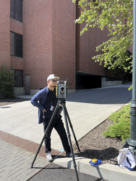
The initiative adopts Trimble Technology Lab resources, including the Trimble S5 Total Station, TX8 LiDAR Scanner, GNSS receiver, Trimble RealWorks, and related surveying accessories to connect precise field measurements with digital models, reinforcing the importance of accurate survey control in modern construction workflows.
Led by Dr. Hongtao Dang, graduate researcher Md Jewel Rana, industry collaborator Matthew Ivers (Revizto), and surveying collaborator Dr. Karl Olsen, the project has already produced proof-of-concept models, augmented point clouds, and a virtual model of the Spark Building. These early results demonstrate how field data can be transformed into coordinated digital assets for visualization, analysis, and future facility management.
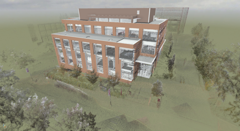
Beyond its research outcomes, the initiative is creating new learning opportunities for students in Construction Management, Civil Engineering, Architecture, and related disciplines. Participants gain experience with professional workflows that span field surveying, LiDAR scanning, point cloud processing, scan-to-BIM modeling, and digital coordination—skills that are increasingly sought after throughout the architecture, engineering, and construction industries.
As the project expands, the team plans to integrate these workflows into future coursework while exploring additional applications for campus planning, facility maintenance, and digital twin development.