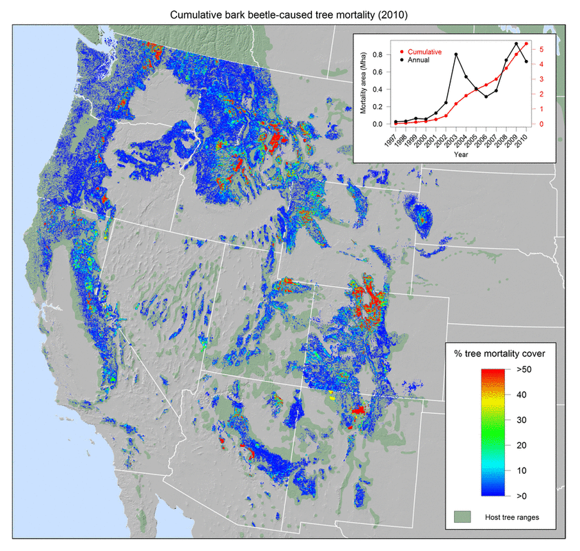
Gridded Aerial Survey Cumulative Tree Mortality Area
Please contact me to learn about the different versions, appropriate use, and limitations of these data. Thanks to the United States and Canadian forest management personnel for acquiring and processing the aerial surveys, and the USDA Forest Service and British Columbia Ministry of Forests for making these data available.
Personnel
This was Arjan Meddens’ PhD work at the University of Idaho. There, he was advised by PI, Jeff Hicke.
Funding
The funding sources varied for this work and included grants from USGS, NSF, and NASA.