The Watershed Uncertainty Project
What’s so uncertain about an integrated hydrologic model?
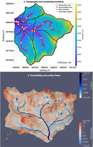
The short answer is everything. When you see a simulation, or a report about one, there is usually a colorful picture that shows water levels, or rivers, or saturation, or something like that but how was that simulation built? You can see the general process on our Applications page but, basically, we have to define values for all the model parameters in every cell. So do we go out and measure them for every cell? What if some cells are different sizes? How can we define properties for something 200ft below the ground?
The fact is that those parameters are our best guesses and we say there is “uncertainty” around what those values should be. To quantify the range of possible behaviors we need to run lots of different versions of the same model (same rainfall input, for example) but with different parameters in each cell. Integrated Hydrologic Models (IHMs) are computationally intense because of how complex the equations they’re solving are, so it might take weeks to run one version of the model and this is why no one has looked into how that uncertainty might change conclusions, until now.
The purpose of this ongoing project is precisely that: run large ensembles of a highly realistic representation of a watershed in central Idaho, and look at its performance under different rainfall scenarios. It’s ongoing work, but the papers produced by the project so far can be found here:
- Impacts of Permeability Uncertainty in a Coupled Surface‐Subsurface Flow Model Under Perturbed Recharge
- Impacts of Uncertain Permeability Fields on the Transient Hydrologic Response in Coupled Surface‐Subsurface Simulations of a Headwaters Catchment
And all the datasets we’ve produced are here:
As more are created they’ll be added here.